Clusters of showers and thunderstorms continue across North Alabama this afternoon and evening. We have had a couple storms turn severe today, including one that snapped power lines along Highway 67 near Priceville in Morgan County. Heavy rain and frequent lightning will be possible with any storms today and there still remains a low end risk for stronger storms to produce damaging winds up to 60 MPH until sunset. Any storm that does become marginally severe will be short lived.
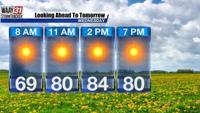
Storms that developed today helped to provide some brief relief from the heat and humidity. Those who didn't see storms today still reached the low 90s with feels like values in the lower triple digits. The forecast is nearly identical Sunday as we stay hot and humid with afternoon pop up storms. By Monday, a high pressure centered across the Plains starts to have greater influence on our weather pattern. This will end our rain chances for the start of the work week and keep temperatures seasonable in the upper 80s to near 90. We should see some relief in the humidity as winds shift to the north and northwest. We'll also keep a close on the tropics late next week and into next weekend, but it is still too early for specifics at this time.